


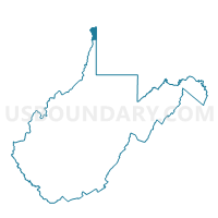
Voting District 11, Hancock County, West Virginia
About
Outline

Summary
| Unique Area Identifier | 690702 |
| Name | Voting District 11 |
| County | Hancock County |
| State | West Virginia |
| Area (square miles) | 8.93 |
| Land Area (square miles) | 8.82 |
| Water Area (square miles) | 0.11 |
| % of Land Area | 98.73 |
| % of Water Area | 1.27 |
| Latitude of the Internal Point | 40.48411210 |
| Longtitude of the Internal Point | -80.56251430 |
Maps


Graphs
Select a template below for downloading or customizing gragh for Voting District 11, Hancock County, West Virginia


Neighbors
Neighoring Voting District (by Name) Neighboring Voting District on the Map
- Voting District 10, Hancock County, WV
- Voting District 12, Hancock County, WV
- Voting District 13, Hancock County, WV
- Voting District 8, Hancock County, WV
- Voting District 9, Hancock County, WV
- HANOVER TWP VTD WEST, Beaver County, PA
- PRECINCT TORONTO 4-A, Jefferson County, OH
Top 10 Neighboring County Subdivision (by Population) Neighboring County Subdivision on the Map
- Grant district, Hancock County, WV (10,311)
- Clay district, Hancock County, WV (10,092)
- Knox township, Jefferson County, OH (4,670)
- Hanover township, Beaver County, PA (3,690)
Top 10 Neighboring Place (by Population) Neighboring Place on the Map
Top 10 Neighboring Unified School District (by Population) Neighboring Unified School District on the Map
- Hancock County School District, WV (30,676)
- South Side Area School District, PA (6,711)
- Toronto City School District, OH (5,663)
Top 10 Neighboring State Legislative District Lower Chamber (by Population) Neighboring State Legislative District Lower Chamber on the Map
- State House District 95, OH (106,820)
- State House District 46, PA (62,516)
- State House District 1, WV (32,812)
Top 10 Neighboring State Legislative District Upper Chamber (by Population) Neighboring State Legislative District Upper Chamber on the Map
- State Senate District 30, OH (338,710)
- State Senate District 46, PA (235,908)
- State Senate District 1, WV (95,975)
Top 10 Neighboring 111th Congressional District (by Population) Neighboring 111th Congressional District on the Map
- Congressional District 4, PA (647,418)
- Congressional District 6, OH (623,742)
- Congressional District 1, WV (615,991)
Top 10 Neighboring Census Tract (by Population) Neighboring Census Tract on the Map
- Census Tract 6050.02, Beaver County, PA (3,820)
- Census Tract 211, Hancock County, WV (3,717)
- Census Tract 212, Hancock County, WV (3,706)
- Census Tract 112, Jefferson County, OH (2,076)